ΚΑΤΗΓΟΡΙΕΣ
NEWSLETTER
Συπληρώστε το email σας
για να λάβετε τις προσφορές
και τα νέα της Bookstation
ΝΕΟΙ ΤΙΤΛΟΙ
-
Νέος Κώδικας για Δημόσιες Συμβάσεις -11η έκδοση
Κωτσοβίνος Ευαγ. Βασίλης προσθήκη στο καλάθι
ISBN 978-618-84598-2-3
Τιμή | 54 € -
Πλήρης Οδηγός Φορολογιών Κατοχής Ακινήτων (Δήλωση Ε9/ΕΝΦΙΑ-Πιστοποιητικό/ΕΦΑ)
Αννα Κόλλια προσθήκη στο καλάθι
ISBN 978-618-83144-9-8
Τιμή | 54 € -
Οι κωδικοί του Ε9 (Δήλωση Ακινήτων)-2024 -ΑΜΕΣΑ ΔΙΑΘΕΣΙΜΟ
Ορέστης Εμμ. Σεϊμένης-Μανούσος Ιωάν. Ντουκάκης προσθήκη στο καλάθι
ISBN 978-618-87035-0-6
Τιμή | 54 €
περισσότερα >
Κατηγορίες / . / Ιατρική & υγεία / Ιστορία / European Cartography and Politics: The Case of Macedonia
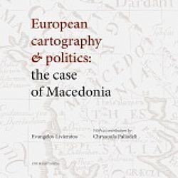
European Cartography and Politics: The Case of Macedonia
Livieratos Evangelos, Paliadeli Chrysoula
Εκδόσεις
University
ISBN: 978-960-456-372-2
Σελίδες: 144 έγχρωμες
Σχήμα: 270 x 270 mm
Εξώφυλλο: Χαρτόδετο
Ημερομηνία έκδοσης: 2012
Τιμή | 33,39 €
Preface
The initiative for this project started before 2009, within the framework of my research as a professor of classical archaeology at the School of History & Archaeology, at the Aristotle University of Thessaloniki and as a long-term excavator of the archaeological site at Vergina - Aegae, the cradle of the ancient Macedonian kingdom.
Having for many years participated in and directed the University's archaeological research at Aegae, the old capital of ancient Macedonia and having dealt with its history and archaeology throughout my career, I was interested in compiling a visual cartographic record of the changing borders of the ancient Macedonian kingdom between the beginning of its creation in the mid-7th century BC and the end of its independence in the 2nd century BCE, as a means of investigating some of the roots and causes of the so-called Macedonian Question.
The interest in compiling a cartographic record of the borders of ancient Macedonia led to the idea that a series of maps depicting the history of the land from antiquity up until the early 19th century could shed new but scholarly light on an international discussion that seems to be poorly informed on the complex issues involved.
For a classical archaeologist who has for almost a lifetime been excavating the territory where the ancient Macedon kingdom first took shape, the challenge of working with historical maps was more than simply an opportunity to satisfy a professional curiosity. It was a highly inviting intellectual and cultural exercise comparable, in many ways, to embarking on a new archaeological project.
To my good fortune, the project brought me into contact with the old friend and colleague Evangelos Livieratos, Professor of Geodesy & Cartography at the School of Surveying Engineering, at the Aristotle University of Thessaloniki, an internationally reputable expert in cartographic heritage.
Prof. Livieratos and I spent many hours together discussing the content of the book, the best approach to the subject and especially the time span that should be covered in such a project.
Our discussions had ups and downs - more downs than ups to be honest - but our strong conviction in the need to finalise the project within the spirit that is so integral to the European academic tradition, gave us strength to complete the enterprise.
At first we thought it safer to cover only the period that is considered in the relevant cartographic literature to lie under the influence of Ptolemy's Geographia, in other words, to confine our research to the period that reflects the European perception of ancient Macedonia, a period extending from Ptolemy's time (and even earlier, from Herodotus' first spatial definitions of the region) up until the early 19th century, a period of almost twenty-five centuries.
In this way the intriguing period from the mid-19th century onwards, the period in which the so called ethnographic maps were invented, would be kept outside the picture. Adopting this policy would avert the mental and physical stress of delving into the notorious contentious field of ethnographic mapping, as was implemented in Europe from the mid-19th century up until World War II, and which in most cases had catastrophic results, especially in the Balkans.
Soon, we both realised that if the book did not deal with maps relevant to the cartographic issues of the Eastern Question and its by-product, the Macedonian Question, the final result risked, at the end being incomplete, unbalanced or even misleading. So, finally, we decided to extend our research to the fall of the Ottoman Empire, which coincides with the end of World War I and to re-examine ethnographic mapping as a special, though unreliable cartographic typology.
Our decision to include a period in which the region was rapidly and violently transformed as a consequence of the decay and final fall of the Ottoman Empire, with the Great Powers by no means indifferent to the question of succession and the new geopolitical setting in South-East Europe, together with a reconsideration of the political role of ethnographic mapping could only add to the project and its scholarly value.
The discerning readers of this publication will have at their disposal a complete picture of how the region of Macedonia was represented on maps in the twenty-five centuries of European cartographic tradition and how its name was placed on those maps. This picture, plus the overview provided of the additional century of ethnographic mapping, will enable the reader to follow the cartographic history of Macedonia as a whole.
Both Prof. Livieratos and myself hope that this book will be of help to those who wish to approach the delicate present-day state of the Macedonian Question through the medium of maps. It is hoped that the book will be instructive for those who have little or no knowledge of the dispute over the use of the geographic term «Macedonia» and the spatial definition of its territory, and also attractive to people who simply love maps, of whom there are, fortunately, many!
A number of colleagues who contributed to this fascinating and challenging work merit our warmest thanks: Dr. Chrysoula Boutoura, Professor of Digital & Thematic Cartography at our University, who offered data and expertise in map processing; Dr. Angeliki Tsorlini, holder of a recent doctorate on Ptolemy's Geographia, who implemented the modern mapwork used in this study; the archaeologists Dr. A. Kyriakou, Dr. E. Mitsopoulou and A. Tourtas, who assisted me, especially after July 2009, when I was elected as a Member of the European Parliament, in collecting all the relevant historical and archaeological evidence on ancient Macedonia, a land whose cartographic depiction through the centuries may illuminate the multifaceted aspects of an issue which seems to be over-simplified, when restricted only to the international issue over the name «Macedonia» its origins and use or misuse. Last but not least, special thanks are due to Andrew Hendry who patiently and carefully edited the texts in English.
Evangelos Livieratos and I are proud to offer the European public the outcome of an interdisciplinary study that has been consciously carried out in full accordance, we believe, with the principles of academic ethics. We wish that the readers of this collection will enjoy reading it as much as we enjoyed creating it.
Dr. Chrysoula Paliadeli | Professor of Classical Archaeology, Member of the European Parliament
ΑΝΑΖΗΤΗΣΗ
Σε όλες τις κατηγορίες
ΑΝΑΚΟΙΝΩΣΕΙΣ
9/5/2012 2:16:56 μμ
περισσότερα >
BEST SELLERS
-
Νέος Κώδικας για Δημόσιες Συμβάσεις -11η έκδοση
Κωτσοβίνος Ευαγ. Βασίλης
προσθήκη στο καλάθι
ISBN 978-618-84598-2-3
Τιμή | 54 € -
Λατινικά ...για 20! (για τη Γ' Λυκείου)
Χρήστος Ζηκούλης προσθήκη στο καλάθι
ISBN 978-618-5837-00-6
Τιμή | 50 € -
Λατινικά...για 20! (Για τη Β' λυκείου)
Χρήστος Ζηκούλης προσθήκη στο καλάθι
ISBN 978-618-86835-9-4
Τιμή | 25 €
περισσότερα >
